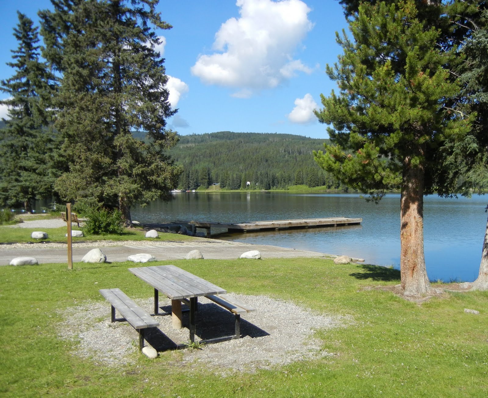
With the forecast yesterday predicting +20 and sunny, we went out to Elk Island Park for the first time this year to have a picnic at
Astotin Lake. It started a bit grey while I was loading up the car and got progressively darker while we drove out. By the time we got there (in shorts and T-shirts), it was 13 degrees and the wind was really blowing.

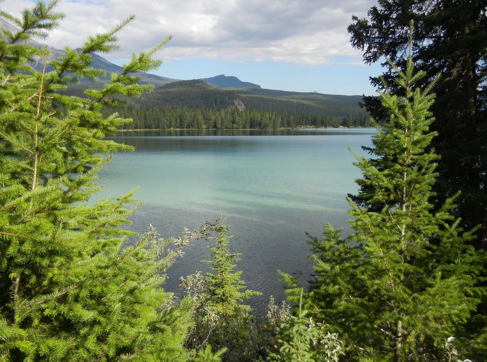
There were some hardy kayakers taking to the water and several more sitting in the cars, seeing what would happen. As usual, the winds didn't really translate into much wave action on the lake, even when the wind shifted from the east to the north--there were some small swells, but no white caps.
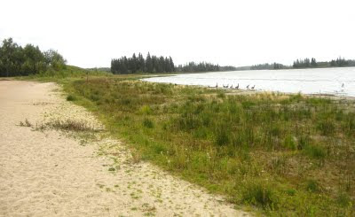
The lake level remains very low, despite the wet summer which makes launching off the beach tricky due to the
drop off. The green band between the beach and the water is the old lake bottom. There is easily 40 feet of beach cropped out of the left of the picture and then 20 or more feet of exposed lake bottom. I forgot to go past the boat launch to see if it was functional.
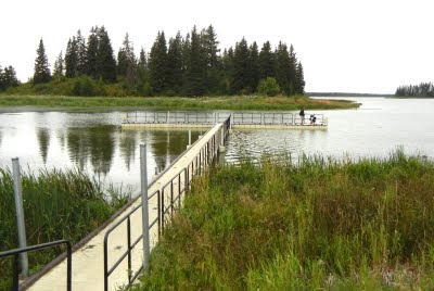
We decided to ride out bikes and poked around the boardwalk on the SE corner of the lake. The park has added a new section to the boardwalk (as the old boardwalk was has become landlocked) with dropping lake levels. We then rode along a paved trail the runs east-west along the south end of the lake, leaving out of the golf course parking lot.
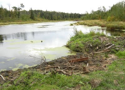
The beavers have been busy along the trail. In the foreground, you can see the top of a metal grate that protects a culvert from floating logs. The beavers from the dam (in the background) have packed this end of the creek full of mud and created a nice pond. On the other side of the trail, you can see the "true" level of the land, about five or six feet lower than the water level in the pond.
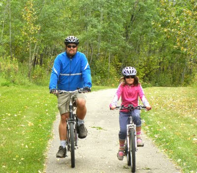
We had a lovely bike ride along the trail, seeking lots of buffalo and coyote poop but not animals. Then the weather turned further, dropping to 10 degrees, with wind and rain so we had a good sprint back to the car. I hadn't though of Elk Island as a cycling destination but the trail was lovely. Next time I might ride in to Astotin from the south gate.
 There were some hardy kayakers taking to the water and several more sitting in the cars, seeing what would happen. As usual, the winds didn't really translate into much wave action on the lake, even when the wind shifted from the east to the north--there were some small swells, but no white caps.
 The lake level remains very low, despite the wet summer which makes launching off the beach tricky due to the drop off. The green band between the beach and the water is the old lake bottom. There is easily 40 feet of beach cropped out of the left of the picture and then 20 or more feet of exposed lake bottom. I forgot to go past the boat launch to see if it was functional.
 We decided to ride out bikes and poked around the boardwalk on the SE corner of the lake. The park has added a new section to the boardwalk (as the old boardwalk was has become landlocked) with dropping lake levels. We then rode along a paved trail the runs east-west along the south end of the lake, leaving out of the golf course parking lot.
 The beavers have been busy along the trail. In the foreground, you can see the top of a metal grate that protects a culvert from floating logs. The beavers from the dam (in the background) have packed this end of the creek full of mud and created a nice pond. On the other side of the trail, you can see the "true" level of the land, about five or six feet lower than the water level in the pond.
 We had a lovely bike ride along the trail, seeking lots of buffalo and coyote poop but not animals. Then the weather turned further, dropping to 10 degrees, with wind and rain so we had a good sprint back to the car. I hadn't though of Elk Island as a cycling destination but the trail was lovely. Next time I might ride in to Astotin from the south gate.