Friday, August 1, 2014

Vermilion Lakes, Banff

The Vermilion Lakes are located due west of the town of Banff and can be accessed from the townsite (via Forty-Mile Creek) or directly from the Vermilion Lakes Road. Oddly, Forty-Mile Creek is listed as Echo Creek on the google map below.


The Banff Canoe Club rents both kayaks and canoes. We launched from their beach which gives access to both the Bow River and 40-Mile Creek. 


The first lake is located about a 15-minute paddle up 40-Mile Creek, which includes passing under a train bridge and navigating some deadfall.


The first lake is a pleasant paddle with a roundtrip of about an hour. Access to the other two lakes is via another creek (along the north side of the lake paralleling the road--hard to see from the water). Doing the second two lakes would add about another hour to your trip.


The scenery is spectacular, although the lakes are shallow. The furtherest lake has a natural hot spring. We saw an Osprey catch a fish and paddled past a family of nearly mature Canada Geese feeding on the weeds.


You can see the dock you can launch directly into the lake from in the picture below. The cut in the bank above is the TransCanada Highway.


The return down Forty-Mile creek is a bit more fun as you have the help of the current. Some of the turns are tight (as evidenced by the many bow prints on the muddy banks!).


 The creek was fairly busy the day were were there and lovely photos abound.


Overall, a nice paddle suitable for first timers with limited endurance and skill.

Monday, May 19, 2014

Sturgeon River and Big Lake, St Albert

A spring bike ride took us along the banks of the Sturgeon River in St Albert this weekend. The trail leads west out of town to Big Lake. On our way back, we noticed the river was high enough that the boat launch was actually feasible. I've wanted to canoe the Sturgeon for awhile.


We decided to take advantage of the spring water and hauled the canoe back there today. The boat launch is on the north side of the river, accessible off Mission Avenue. There is a public parking lot right there so the carry is less than 100 feet. The place was hopping with a dozen kayaks and two canoes on the river.


The water was high so the river was navigable down to at least Boudreau Road. We decided to go upstream towards Big Lake to check out the old trestle bridge and the wildlife.


We had a lovely paddle with lots of waterfowl and red-winged black birds. Paddling through a downtown with people on the trails and playing guitar up in the trees (local colour, as my dad would say) was a very different and enjoyable experience. Past the bridges the traffic thinned out some.


We saw at least seven muskrats out, including a pair playing. The best shot I could get (while steering) was this one (the brown smudge in the centre is the muskrat). Jess got very close to a pair of them (maybe four feet).


Overall, a lovely hour on the river. Nothing too challenging except staying in a channel deep enough to get a paddle in. The Sturgeon is much more suited to kayaks.

Sunday, August 5, 2012

Blackstrap Lake

Blackstrap Lake is located about 30 minutes south of Saskatoon on Highway 11. On the east side of the lake is Blackstrap Lake Provincial Park. The narrow lake was created in 1967 and is about 14km long. It is bisected by a causeway, but there is a boat pass through to get between the halves.


The public boat launch is located south of Blackstrap Ski Hill (pictured below), in the provincial park. You can also launch off the public beach, if you don’t mind a 200-foot carry from the parking lot in the Aspen Grove picnic area.


The lake is fairly warm, weedy and was full of green algae when we were there. There was enough algae that a fish kill was occurring, which made the already smelly lake rather odiferous. There isn’t all that much to see (although we did see pelicans and a large number of fowl and other birds). All told, not a lake we’d go back to.


There are few services in the park or the surrounding area. The gas station/grocery store/subway/motel in Dundurn is about the only place to buy food or fuel without going back to Saskatoon.

It may also be possible to canoe into Indi Lake (via a river) from the south end of Blackstrap Lake, but we didn’t get that far on this trip. Based on google maps, I would say you’d end up portaging 2km, incuding crossing a divided highway!

Monday, July 2, 2012

Astotin Lake, Elk Island National Park

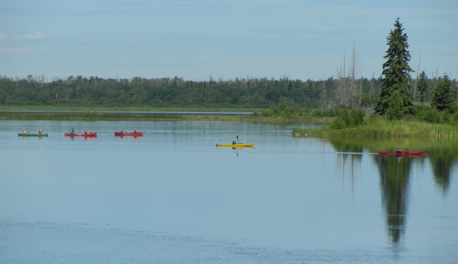
We took the bikes out to Elk Island this weekend and the place was hopping. I've been canoeing there for years and I don't think I've ever been able to get five boats in one shot (with two more just out of the frame to the right).


The water levels are the same as 2011, but lots of folks were putting in off the main beach and the parking lot was full of kayaks and canoes. If we go back to camp this year, I may put the canoe on (assuming I can recall how the roof-racks work) and go for a solo paddle.


There was also a lot of birds, including half a dozen pelicans.


I always forget just how big these birds are until you get close. Fortunately, they mostly bolt from boaters although this fellow was only about 10 feet from these kayakers before he pulled the pin.


As planned, we rode around a bit and then I rode back to the main gate. It was only 13km but there are a lot more hills in the country than in town. I thought I was doing well until a pair of 60-year-olds on a tandem passed me like I was a statue.

Saturday, June 16, 2012

Sturgeon River and Big Lake, St Albert


The Sturgeon River flows from Big Lake, eastward through downtown St Albert and (eventually) dumps into the North Saskatchewan.  I've always wanted to paddle this but doubted it was doable in a canoe (maybe a kayak). We were out today cycling along the river and saw two canoes in the water so (proven wrong) I dug out my pictures from last summer.

One of the challenges with the Sturgeon is that it is silty and often has low water levels, especially during the summer. Even today (after a lot of rain) the water was quite low through town. There are also no really good entry points—its going to be a muddy entry no matter how you approach it.


There is a boat launch in downtown St Albert (see above), on the north side of the river. Access is off Mission Avenue and it is just across from St Albert place. Alas, the cement runs out long before you get to water so there will be slogging until you get enough depth to float.


A second (informal) put in is on the south side of the river, about 100 feet downstream from the Ray Gibbins Drive Bridge. Access is from the Kinsmen RV campground (there is parking in the roundabout) and there is a dirt trail down to the water through the grass. I did not wander down today to see how the access was.


It may also be possible to put into Big Lake (above) on the south side, although all of the approaches from here seem hooped because of the low water levels and long mud flats.

Paddling is best between Big Lake and the trestle railway bridge by the ball diamonds and St Albert Senior Citizens Club. This is about 2 km long (at a guess) and there is lots of waterfowl (including young today). There are multiple bands of forest and fields and apparently good fishing. Big Lake is also navigable, although often windy.


Downstream from the trestle bridge, the river passes through St Albert and under St Albert Trail. This was navigable today (there were canoes here) but the paddlers could not get the entirety of their blade into the water, especially passing under St Albert Trail—I’d guess there was about three inches of water beneath their keel and there is a good chance of running aground. The current is not very strong, but pushing off a deep muddy bottom would be a chore.

The river looked passable as far down as Boudreau Road (so a total of maybe 3 km downstream of the trestle rail bridge). Here, there were multiple beaver dams on the river, which would require a muddy dismount to get over. My guess is the mud at the bottom of the Sturgeon is effectively bottomless and quite sticky. My understanding from other paddlers is that, further downstream, you run into a morass of dams and quasi oxbows--a trip best avoided.

Sunday, September 11, 2011

Astotin Lake, Elk Island National Park

With the forecast yesterday predicting +20 and sunny, we went out to Elk Island Park for the first time this year to have a picnic at Astotin Lake. It started a bit grey while I was loading up the car and got progressively darker while we drove out. By the time we got there (in shorts and T-shirts), it was 13 degrees and the wind was really blowing.

There were some hardy kayakers taking to the water and several more sitting in the cars, seeing what would happen. As usual, the winds didn't really translate into much wave action on the lake, even when the wind shifted from the east to the north--there were some small swells, but no white caps.

The lake level remains very low, despite the wet summer which makes launching off the beach tricky due to the drop off. The green band between the beach and the water is the old lake bottom. There is easily 40 feet of beach cropped out of the left of the picture and then 20 or more feet of exposed lake bottom. I forgot to go past the boat launch to see if it was functional.

We decided to ride out bikes and poked around the boardwalk on the SE corner of the lake. The park has added a new section to the boardwalk (as the old boardwalk was has become landlocked) with dropping lake levels. We then rode along a paved trail the runs east-west along the south end of the lake, leaving out of the golf course parking lot.

The beavers have been busy along the trail. In the foreground, you can see the top of a metal grate that protects a culvert from floating logs. The beavers from the dam (in the background) have packed this end of the creek full of mud and created a nice pond. On the other side of the trail, you can see the "true" level of the land, about five or six feet lower than the water level in the pond.

We had a lovely bike ride along the trail, seeking lots of buffalo and coyote poop but not animals. Then the weather turned further, dropping to 10 degrees, with wind and rain so we had a good sprint back to the car. I hadn't though of Elk Island as a cycling destination but the trail was lovely. Next time I might ride in to Astotin from the south gate.

Tuesday, August 23, 2011

Chickakoo Lake

Chickakoo Lake is located in the 480-acre Chickakoo Lake Recreation Area, just west of Edmonton on Highway 16. Take Highway 16 to Secondary Highway 779 and turn north. Then turn west on Township Road 534 and the north on Range Road 13.

The main site offers pit toilets, lots of parking and a trail system suitable for walking, mountain biking and horse riding. The loop (Indian Ridge Trail) that leaves the parking lot has several picnic sites. There is also a boat launch and it is a popular fishing hole.

Chickakoo Lake runs NW-SE with the boat launch at the SE corner. Excepting the boat launch, most of the shoreline is reeds and bog.

The trees mean the lake is extremely calm most days and there are a lot of fish jumping (it is stocked each year). We’ve also seen beaver and lots of waterfowl. Others report deer, moose and bear.

To the north of Chickakoo Lake on Range Road 13, you will hit Township Road 540. Turning east will return you to Secondary Highway 779. On the south side of the road, you will see a long lake called Kettle Lake. I have not been able to find a decent entry point to Kettle Lake.

The hiking here is lovely and we might go back to ride our bikes. From a canoeing perspective, wildlife and fishing and the main draws. There are prettier lakes to canoe.